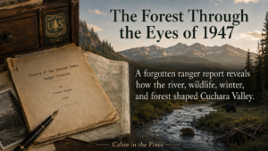
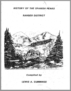
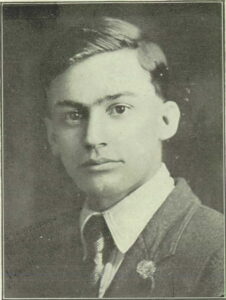
 While scouring through old books in La Veta, it caught my eye. It was a 120-page typed document entitled, History of the Spanish Peaks Ranger District, written by Lewis A. Cummings.(1) Cummings was a legendary Park Ranger, a highly educated man who graduated cum laude with a degree in Topical Forestry from Yale University. Fate brought him to La Veta, Colorado in 1942, where he served as Chief Forest Ranger until his retirement in 1959. Locals called him the “Dean of the San Isabel National Forest.(2) He wrote the original manuscript in 1947 and updated it regularly. After his retirement different organizations continued updating it until 1990.
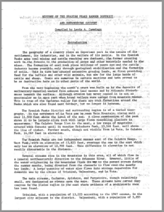
The report was typed in the late 1940s on a manual typewriter, each word pressed into the page through ink and effort. The letters carry the subtle inconsistencies of that process, a reminder that this was not produced by a machine alone, but by a ranger sitting at a desk, recording what he had seen.
It seemed a shame that this kind of priceless history was trapped inside a packet of black and white 8.5×11 paper. I yielded to my curiosity and stood in front of a modern jet printer for over an hour digitizing every page in an optical character recognition format so I would use a modern computer to search the document by word or topic.
After transforming the work into digital form, I did not waste a minute opening it on my Mac, searching for familiar keywords and drawing its history out from the old and tattered analog record.
Then it appeared. The colorful description of bear migrations in the Cuchara Valley. In the original report, the incident is not told as a story. It appears as a brief field note within a larger section on wildlife, recorded alongside entries on coyotes, beaver, and mountain lions. The tone was practical, almost detached, yet behind the clipped sentences I found a vivid moment in the life and history of the valley.
The River, Wildlife’s Freeway
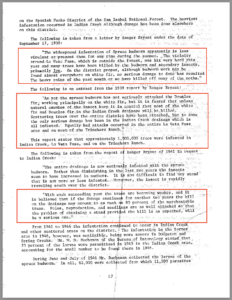
 The report states that bears, drawn by hunger, entered orchards in the valley, feeding on fruit until they were fat and at times coming into conflict with livestock operations.(3)
One account records the damage they left behind in the orchards. Another notes two bears feeding on the carcasses of cattle, a mile apart, somewhere along the North Fork. One of them was later trapped.(4)
This suggests that wildlife regularly crossed into settled areas where food sources were concentrated. For residents of the valley, this likely meant that the boundary between forest and homestead was not fixed, but constantly negotiated.
This was not a story passed down through memory or shaped by local legend. It was written down at the time by those responsible for managing the land. It comes from a Forest Service history of the Spanish Peaks Ranger District, compiled in the years just after World War II. The report reads like a set of field notes, practical and unembellished, but within it is a vivid portrait of the Cucharas Valley as it once was.
A place where the line between wilderness and settlement was still being negotiated.
A Working Landscape
 By the time this report was written, the valley was no longer untouched. Cabins, ranches, and small communities had taken root along the river and its tributaries. Yet the surrounding forest remained active and alive in ways that could not be fully controlled.
The rangers who compiled the report were not simply observing nature. They were managing it. Coyotes were trapped and, in some cases, poisoned to keep their numbers low. Mountain lions were monitored and reduced. Bears were removed when they came too close to human activity.(5)
This was the philosophy of the time. Wildlife was something to be regulated, balanced against the needs of livestock, property, and people. The goal was not preservation in the modern sense, but stability.
Even so, the report reveals an important truth. Despite human effort, the land retained its own rhythms.
The Creek as a Corridor
Nearly every story in the report traces back to water. The bears followed the Cucharas. Beaver built their dams along its tributaries. The creeks and Cucharas River were not just a source of wather. They supported fish and other species. Wildlife seemed to move through the valley using the same corridors that water carved over centuries.
The report notes that most creeks with suitable vegetation supported beaver dams, and where beaver had been removed, those dams quickly washed away during high water. Without using modern terminology, the rangers were describing something we understand more clearly today. The river system was not just a feature on the landscape. It was the organizing structure of the ecosystem. Water shaped movement. Water shaped habitat. Water shaped life in the valley.
The Winter That Changed Everything
The report also captures moments when nature asserted itself with sudden force.
In November of 1946, a severe storm dropped four to five feet of snow across the region surrounding the Spanish Peaks. The impact on wildlife was immediate. Turkeys were found frozen or badly injured. Populations declined sharply in a single season.(7)
No policy could prevent it. No management plan could soften it.
Events like this remind us that while the valley was being shaped by human hands, it was never fully controlled.
A Record of Transition
 What makes this document especially valuable today is not just what it records, but when it was written and how solutions were described. From a modern perspective, these observations reveal that ecological relationships were not yet fully understood at the time. For example, the report mentions ..
- Predator control was carried out through lethal removal.
- Bears were often assumed as killers. The report reveals that bears were seen as predatory animals and that if “seen feeding he is immediately trapped as a killer”.(8)
- Disregard for ecosystem consequences. The report notes that beaver were removed or hunted from some streams and that their dams did not persist afterward. This resulted in poor watershed health, diminished biodiversity and a disregard for long-term ecological impact.(9)
- Wildlife was viewed through a utilitarian lens. animals were evaluated largely by their impact on livestock and hunting.
The fact that these practices are unacceptable today does not mean past stewards were ruthless, uneducated, or unconcerned about sustaining the forrst. On the contrary, it is evidence that we have grown, evolved, and learned how to better steward the forest ecosystem.
The mid-1940s represent a transitional period in the history of land management in the American West. The conservation movement launched in the early twentieth century had already set aside these forests for long-term protection. Yet the mindset of earlier decades still lingered in how wildlife and land were managed on the ground.
The result is a record that sits between two eras. It reflects a time when the forest was protected, but still actively controlled. When wildlife was observed carefully, but often reduced when it conflicted with human use. When the river was central to life in the valley, even if its broader ecological role was not yet fully understood.
What Still Remains
 Today, much has changed in the Cucharas Valley. Scientific understanding has deepened. Conservation practices have evolved. Water supply, forest health, and wildfire risk now dominate public conversation. And yet, much has not changed.
The river still runs through the valley as it always has. Wildlife still follows its course. Winter storms still arrive with little regard for human plans.
The old Forest Service report even mentions similar challenges we face today, It identifies the primary cause of widespread tree mortality as a spruce budworm infestation, noting that bark beetles, likely of the Scolytus species, followed and completed the kill in already weakened stands.(10) Not the beetle kill we face today, but a very similar challenges. Perhaps, the Valley is more resilient than we give it credit for.
The report does not predict our present challenges. It does something more valuable. It shows us the system as it behaved when observed up close, before modern language and models were applied to it. It reminds us that the story of the Cucharas River is not new. It has always been the thread that ties the valley together.
Readers who would like to explore the original source can download the full 1947 ranger report in PDF format here.
Footnotes
Parenthetical numbers in the text (e.g., 5) correspond to the sequentially numbered citations listed below.
1. Lewis A. Cummings, History of the Spanish Peaks Ranger District (San Isabel National Forest, compiled 1947; additions through the 1950s).
2. Lewis A. Cummings, History of the Spanish Peaks Ranger District (San Isabel National Forest, compiled 1947; additions through the 1950s), introduction)
3. Lewis A. Cummings, History of the Spanish Peaks Ranger District (San Isabel National Forest, compiled 1947; additions through the 1950s), printed page number 29.
4. Lewis A. Cummings, History of the Spanish Peaks Ranger District (San Isabel National Forest, compiled 1947; additions through the 1950s), printed page number 80.
5. Lewis A. Cummings, History of the Spanish Peaks Ranger District (San Isabel National Forest, compiled 1947; additions through the 1950s), printed page number 81.
6. Lewis A. Cummings, History of the Spanish Peaks Ranger District (San Isabel National Forest, compiled 1947; additions through the 1950s), printed page number 81.
7. Lewis A. Cummings, History of the Spanish Peaks Ranger District (San Isabel National Forest, compiled 1947; additions through the 1950s), printed page number 81.
8. Lewis A. Cummings, History of the Spanish Peaks Ranger District (San Isabel National Forest, compiled 1947; additions through the 1950s), printed page number 80.
9. Lewis A. Cummings, History of the Spanish Peaks Ranger District (San Isabel National Forest, compiled 1947; additions through the 1950s), printed page number 81.
10. Lewis A. Cummings, History of the Spanish Peaks Ranger District (San Isabel National Forest, compiled 1947; additions through the 1950s), printed page number 68
11. Author’s note: In preparing this article, the author used AI-assisted tools for research support, proofreading, fact-checking, and stylistic refinement. All narrative choices, analysis, and historical interpretations are the author’s own, and responsibility for accuracy rests solely with the author. The blog’s research methodology statement is available at https://cabininthepinescuchara.blogspot.com/2019/03/methodology-sources-and-use-of-research.html